The “British Solution” has traditionally been to draw new lines on maps. In India, in Africa, in Arabia and the Middle East and even in the Eastern US and Canada, the British expertise at and love of cartography has provided the “solutions” of the day. Notwithstanding any tribal affiliations and nomadic behaviour, ethnic and religious and political divisions have been enshrined – and confined – in situ by drawing lines on maps to keep the warring parties separated.
After this election, a federal Britain is now in the realm of the possible – if not yet probable. And the British Solution should be applicable without really inventing anything new. 1,800 years ago the Romans already drew the lines that could be applied.
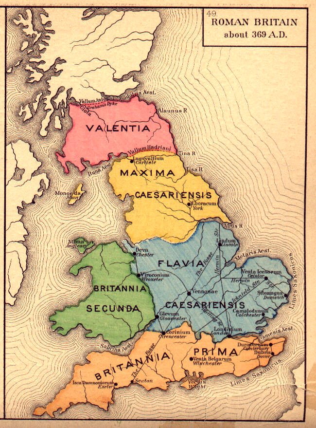
roman britain (thedockyards.com)
Of course this requires that Scotland be split into a northern and a southern part and they would, obviously, be called Upper Scotland and Lower Scotland. England would have to split into three parts (with a somewhat expanded Wales). Upper England, Middle England and Lower England would be quite fitting.. Wales would of course be called Cymru. Northern Ireland (Ulster) could pretty much stay as it is (geographically). Manx, the Channel Islands, the Falklands and the Hebrides could be independent Crown territories and could serve as tax and gambling havens (since any self-respecting federal, monarchic, republic must have these).
The great job-creation opportunity is that 9 parliaments (8 national and one federal parliament) could be set up, each with its supporting paraphernalia and bureaucracy. And it could be 10 parliaments if the House of Lords is kept as a tourist attraction.
And Welsh place names would continue to be used.
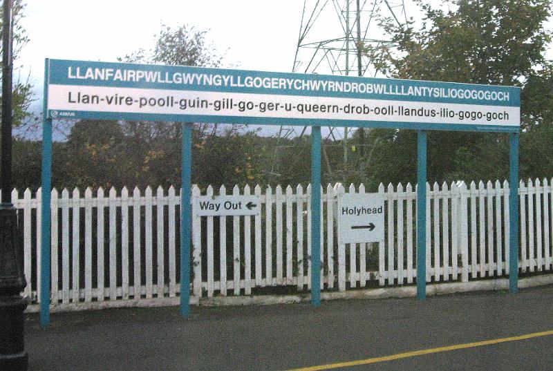
llanfair pg station
Tags: British Solution, Federal Britain
