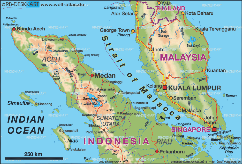
If MH370 was in fact hijacked and this report from Reuters (in full below) about the radar data is correct, then the “diverted” flight path of MH370 looked like this: (See expanded map here via The Guardian for details). Somebody with much experience of flying must have been in charge of the aircraft. No doubt the passengers and crew are being investigated to see who else apart from the pilots had that kind of experience.
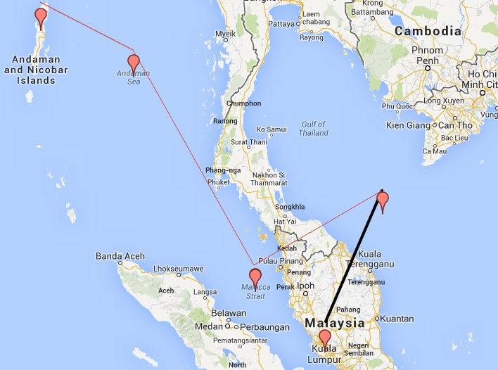
MH370 Presumed Diverted Flight Path
(See also this map reconstructed and tweeted by Singapore Today and this one from AirInfo. All are based on the Reuters report and the locations of the navigation waypoints).
UPDATE! — The presumed flight path – even if correct – is 7 days old. The Indian search effort is now to include hundreds of uninhabited islands in the Andaman and Nicobar chain. (Of 572 islands in the chain only 37 are inhabited).
The WSJ also seems to confirm the flight of the plane westwards.
Malaysia Airlines’ missing jet transmitted its location repeatedly to satellites over the course of five hours after it disappeared from radar, people briefed on the matter said, as searchers zeroed in on new target areas hundreds of miles west of the plane’s original course.
The satellites also received speed and altitude information about the plane from its intermittent “pings,” the people said. The final ping was sent from over water, at what one of these people called a normal cruising altitude. They added that it was unclear why the pings stopped. One of the people, an industry official, said it was possible that the system sending them had been disabled by someone on board.
The people, who included a military official, the industry official and others, declined to say what specific path the transmissions revealed. But the U.S. planned to move surveillance planes into an area of the Indian Ocean 1,000 miles or more west of the Malay peninsula where the plane took off, said Cmdr. William Marks, the spokesman for the U.S. Seventh Fleet.
Radar data suggests missing Malaysia plane deliberately flown way off course – sources
Military radar data suggests a Malaysia Airlines jetliner missing for nearly a week was deliberately flown hundreds of miles off course, heightening suspicions of foul play among investigators, sources told Reuters on Friday.
Analysis of the Malaysia data suggests the plane, with 239 people on board, diverted from its intended northeast route from Kuala Lumpur to Beijing and flew west instead, using airline flight corridors normally employed for routes to the Middle East and Europe, said sources familiar with investigations into the Boeing 777’s disappearance.
Two sources said an unidentified aircraft that investigators believe was Flight MH370 was following a route between navigational waypoints when it was last plotted on military radar off the country’s northwest coast.
This indicates that it was either being flown by the pilots or someone with knowledge of those waypoints, the sources said.
The last plot on the military radar’s tracking suggested the plane was flying toward India’s Andaman Islands, a chain of isles between the Andaman Sea and the Bay of Bengal, they said.
Waypoints are geographic locations, worked out by calculating longitude and latitude, that help pilots navigate along established air corridors.
A third source familiar with the investigation said inquiries were focusing increasingly on the theory that someone who knew how to fly a plane deliberately diverted the flight.
POSSIBLE SABOTAGE OR HIJACK
“What we can say is we are looking at sabotage, with hijack still on the cards,” said that source, a senior Malaysian police official.
All three sources declined to be identified because they were not authorized to speak to the media and due to the sensitivity of the investigation.
Officials at Malaysia’s Ministry of Transport, the official point of contact for information on the investigation, did not return calls seeking comment.
Malaysian police have previously said they were investigating whether any passengers or crew had personal or psychological problems that might shed light on the mystery, along with the possibility of a hijacking, sabotage or mechanical failure.
As a result of the new evidence, the sources said, multinational search efforts were being stepped up in the Andaman Sea and also the Indian Ocean.
LAST SIGHTING
In one of the most baffling mysteries in modern aviation, no trace of the plane nor any sign of wreckage has been found despite a search by the navies and military aircraft of more than a dozen countries.
The last sighting of the aircraft on civilian radar screens came shortly before 1:30 a.m. Malaysian time last Saturday (1730 GMT Friday), less than an hour after it took off from Kuala Lumpur, as the plane flew northeast across the mouth of the Gulf of Thailand. That put the plane on Malaysia’s east coast.
Malaysia’s air force chief said on Wednesday an aircraft that could have been the missing plane was plotted on military radar at 2:15 a.m., 200 miles northwest of Penang Island off Malaysia’s west coast.
This position marks the limit of Malaysia’s military radar in that part of the country, a fourth source familiar with the investigation told Reuters.
When asked about the range of military radar at a news conference on Thursday, Malaysian Transport Minister Hishammuddin Hussein said it was “a sensitive issue” that he was not going to reveal.
“Even if it doesn’t extend beyond that, we can get the co-operation of the neighboring countries,” he said.
The fact that the aircraft – if it was MH370 – had lost contact with air traffic control and was invisible to civilian radar suggested someone on board had turned off its communication systems, the first two sources said.
They also gave new details on the direction in which the unidentified aircraft was heading – following aviation corridors identified on maps used by pilots as N571 and P628. These routes are taken by commercial planes flying from Southeast Asia to the Middle East or Europe and can be found in public documents issued by regional aviation authorities.
In a far more detailed description of the military radar plotting than has been publicly revealed, the first two sources said the last confirmed position of MH370 was at 35,000 feet about 90 miles off the east coast of Malaysia, heading towards Vietnam, near a navigational waypoint called “Igari”. The time was 1:21 a.m..
The military track suggests it then turned sharply westwards, heading towards a waypoint called “Vampi”, northeast of Indonesia’s Aceh province and a navigational point used for planes following route N571 to the Middle East.
From there, the plot indicates the plane flew towards a waypoint called “Gival”, south of the Thai island of Phuket, and was last plotted heading northwest towards another waypoint called “Igrex”, on route P628 that would take it over the Andaman Islands and which carriers use to fly towards Europe.
The time was then 2:15 a.m. That is the same time given by the air force chief on Wednesday, who gave no information on that plane’s possible direction.
The sources said Malaysia was requesting raw radar data from neighbours Thailand, Indonesia and India, which has a naval base in the Andaman Islands.