Posts Tagged ‘Water levels in Murray-Darling Basin’

Murray Darling basin is 87% full, La Niña is back and floods and fires are on the agenda

October 10, 2011
The "Mighty Murray", the longest riv...

The "Mighty Murray": Image via Wikipedia

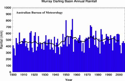
After a decade of drought and two very wet years Australia is facing a third consecutive wet year. La Niña is back and the Murray Darling basin is already 87% full as of 23rd September. Last year levels were the highest since 2001 and this year they are even higher.

Water levels are high across all of Australia except in the West. The ground is also reported well saturated and as the rains come the controlled release of water from the dams system will be crucial to prevent a repeat of this year’s floods in January and February 2012.

The Australian writes:

… if the spring rains continue, the water storage that is so vital to the prosperity of irrigation farmers along the Murray River and to Adelaide’s drinking water supply, will be full by next year. Around the nation, water storage reserves are at levels not seen since the start of the decade-long drought in the late 90s.

The Bureau of Meteorology estimates Australia’s 261 largest drinking water and irrigation storages, with a total capacity of 78 million megalitres of water, are on average 80 per cent full. This time last year, the figure was 65 per cent. 

Drinking water supplies for the major cities have been replenished by the wettest 10-month period ever recorded, between July last year and April. Sydney’s city water storages are now 79 per cent full, while dams supplying Adelaide and Brisbane are at a healthy 83 per cent capacity. Even Melbourne’s once critically low dams have climbed to 63 per cent full with recent rainfall, their highest levels in 12 years. Melbourne’s largest supply dam, the Thomson, is this week half-full for the first time since 2005.

The anomaly is Perth, which is still critically dry, relying on desalination plants and aquifers for 60 per cent of its water supplies. ….. 

… The filling of the giant Dartmouth Dam is an extraordinary feat that has happened just three times since the vast reservoir in the remote Victorian high country was commissioned in 1980. Only in 1990, 1993 and 1997 has water overflowed from the four-million-megalitre dam and thundered down its 180m drop spillway. It’s a far cry from this time last year, when the Dartmouth Dam was just 26 per cent full. Now holding 2.8 million ML of water, according to operators Goulburn-Murray Water, it’s a rejuvenation that has tourists, anglers and irrigation farmers flocking to enjoy the dam’s beauty and plentiful trout.

The level in the Dartmouth Dam is so high that irrigation needs for farmers downstream are assured for about 4 years. But the risk of flooding is being closely watched

La Niña has become synonymous with flooding as a result of above average rainfall. This year is likely to see a re-emergence of both but on a smaller scale than last year. “Above average rain through northern and eastern Australia is likely to once again prompt broad-scale flooding. Areas which will see a return of above average rain include; Queensland, the Northern Territory, northern parts of Western Australia, north-east parts of South Australia, much of New South Wales and northern Victoria,” says Dick Whitaker, Chief Meteorologist at The Weather Channel.

…. The Australian cyclone season runs from November to April and The Weather Channel expects a more active season compared to last year. “This year is likely to be a more active season than last year when despite strong La Niña conditions we saw only 11 cyclones. We are expecting a total of around 12 to 13 cyclones this year in Australian waters, but on average only half of our cyclones actually cross the coast,” says Tom Saunders, Senior Meteorologist at The Weather Channel.

“About 5-6 cyclones can be expected off the north-west coast of Western Australia and two of these should cross the coast, one of which is likely to be severe (category 3 or above),” he continues. “Off the Queensland coast, 4-5 tropical cyclones are likely, with one or two coastal crossings. While off the north coast between the Kimberley and Cape York Peninsula, four cyclones are likely, three of which should cross the coast,” Saunders continues.

“If La Niña conditions strengthen over the next few months as predicted by some models we may add one or two more cyclones to the forecast for each region,” says Saunders.

Paradoxically, “the heavy rains last year have pushed the nation’s grassfire risk to levels not seen in 40 years, with an area in central Australia twice the size of Tasmania having burned since June”.


Water levels in the Murray-Darling basin are highest since 2001

November 14, 2010
Second version of a Murray catchment map

Murray Darling Basin: image via Wikipedia

After 10 years of drought, heavy rainfall has left the Murray-Darling Basin now so full of water that controlled spillages are having to be made to prevent levels becoming too high. The Sydney Morning Herald:

AFTER years of drought, there are dams and reservoirs across the Murray-Darling Basin where controlled spilling is taking place to keep levels within specified limits. The amount of water stored in the basin is close to 19,000 gigalitres, the highest level since November 2001. The Bureau of Meteorology water storage website, which monitors more than 25,000 gigalitres of storage, reports that basin storages are now more than 74 per cent full, compared to 29 per cent a year earlier.

Several reservoirs have reached capacity, including the Menindee Lakes, Burrendong Dam and Blowering Reservoir in NSW, and the Hume Dam on the NSW-Victoria border near Albury. A year ago the Hume Dam was at 39 per cent and the Blowering Reservoir at 36 per cent.

A spokeswoman for the Murray-Darling Basin Authority confirmed it had been forced to spill water from the Hume Dam and Lake Menindee to prevent the storages rising above specified levels. More rain is forecast for the Murray-Darling Basin tomorrow and on Monday, but the bureau’s deputy director for water, Robert Vertessy, said it was ”50/50” whether storages would break through the 75 per cent mark because a lot of the rain was expected to fall in areas that have no further capacity.

”What is spectacular is how much it has gone up in the last year,” Dr Vertessey said. In the long term it was very unlikely that basin storages would ever reach 100 per cent because rainfall patterns varied across the basin and some dams, such as the Dartmouth in north-eastern Victoria, had enormous capacity compared to the drainage area they serviced, Dr Vertessey said.

Replenished water storages mean that many farmers are now receiving their full general allocation of water. Trading of temporary water allocations has ground to a halt in many areas and the price of water in one exchange has fallen to $45 per megalitre, down from $200 a year ago and a peak of about $1200 in late 2007.

Meanwhile the Guide prepared by The Murray-Darling Basin Authority came under fire because the computer models used to prepare the Guide did not (or could not) account for some 20% of the water flows in the basin. The Guide has proposed drastic cuts in irrigation flows and this not at all popular with farmers. The Australian reports:

KEY assumptions about water flows in the Murray-Darling Basin guide are under challenge from newly released figures. It emerged that 20 per cent of basin water flows were not included in scientific models. The models were used to recommend cuts of up to 37 per cent in irrigators’ water entitlements.

In technical volumes published with the guide, the Murray-Darling Basin Authority said the complexity of hydrologic modelling made it difficult to consider a large range of scenarios on sustainable diversion limits in a timely way. Hydrologic models have been developed for all major rivers in the basin in conjunction with the states and the CSIRO. “Overall, about 80 per cent of current surface water use under current diversion limits in the basin is explicitly represented in the hydrologic modelling framework,” the guide says.

The National Farmers Federation seized on the concession, saying it would challenge key assumptions in the guide. NFF chief executive Ben Fargher said he would challenge how the plan had identified environmental assets for protection and the modelling for environmental water requirements. “They are saying because of the complexity of all the hydrological models it has been difficult for them to do the modelling, and so they’ve used analytical tools,” he said. “We are not confident in that. In our view it is not robust, not good enough and we are going to challenge it.” NSW Irrigators Council chief executive Andrew Gregson said the guide’s modelling “has holes in it” and the authority needed to be 100 per cent certain, given the enormous ramifications for the communities along the river.

Last night the authority defended the guide and Wentworth Group of Concerned Scientists chief executive Peter Cosier described the science behind it as “some of the best in the world”. The authority said the 20 per cent of water flows not represented in hydrologic models would not affect recommendations about water allocations or environmental flows.

The 10 years of drought have often been attributed to climate change but rainfall records over the last 100 years  suggest that the variation of rainfall and of the subsequent water levels are nothing unusual. Online opinion has this to say:

The Australian Bureau of Meteorology has information on rainfall right back to 1900. The rainfall record for the Murray Darling Basin (see chart below) shows there have been periods of as low rainfall in the past. The 11-year rolling average, the trend line shown in chart, indicates there has been no general increase or decrease in rainfall over the last 100 years. Carbon dioxide levels have increased by about 30 per cent over this same period.

Indeed the rainfall record for the Murray Darling Basin would suggest it is drawing a long bow to blame the current drought on climate change.

Murray Darling Basin Annual Rainfall