Archive for the ‘Natural Phenomena’ Category

“Poor” Indian monsoon so far unlikely to derail growth

August 30, 2014

With one month to go for the “official” 4 month-long monsoon season, rainfall has been 18% deficient so far. At the half-way mark most states were deficient in rainfall. However about half the states have now crept back to “normal” rainfall. With any El Nino only expected to be weak – if it even actually develops – a catastrophic monsoon can now be ruled out. Rainfall will be below normal but the last month of the monsoon holds some hope for further recovery. There is also some hope that the monsoon – which developed about 10 days late – may also be delayed in withdrawing giving some rainfall into the first two weeks of October. It will still be a “poor” monsoon but may not be labelled “bad” or “catastrophic”.

IMD’s chart covering the 3 months so far is below. Green is “normal”, red is “deficient”, yellow is “scanty” and blue is “excess”:

Monsoon 2014 75%

Monsoon 2014 75%

There is still some risk that a poor monsoon will hold back the industrial recovery somewhat. The growth in the last quarter has been the highest for 2 years as sentiment has turned positive, and is not likely to be reversed by this “poor” monsoon.

BBC: 

India’s economy grew by 5.7% in the three months to June, its fastest pace in two-and-a-half years, according to an official estimate. The economy was helped by strong growth in electricity, gas and water supply, and financial services, the Ministry of Statistics said.

The growth figure was higher than analysts had been expecting. …

….. Ever since the Narendra Modi government took charge, business sentiment has improved on the ground. Investors have started pumping in money again, capital markets have been roaring, consumer demand has revived & hiring has picked up.

But this euphoria is primarily driven by sentiment and more steps would be required to sustain this optimism.

Bárðarbunga, Iceland: A small fissure eruption has started north of Dynjujökull

August 29, 2014

A flight over the glacier has discovered a row of 10-15 m deep cauldrons south of the Bárðarbunga caldera. They form a long line. The cauldrons have been formed as a result of melting, possibly sub-glacial eruption, uncertain when. There are three circular crevasse formations, about 5 km in total length. The ice thickness in the area is 400-600 m. No signs of flooding have been detected.

Now a small fissure eruption further north has been detected.

The Aviation Colour Code remains at the ‘orange’ level for Bárðarbunga.

Iceland Met Office reports:

A fissure eruption has started north of Dynjujökull.

29th August 2014 02:45 – An eruption north of Dyngjujökull

An eruption started in Holuhraun north of Dyngjujökull at around 00:02. Seismic tremor was observed on all seismic stations and the web camera installed in the area by Mila has showed some nice pictures of the eruption.  It is a small fissure eruption and at 02:40 AM the activity appears to have decreased.

28th August 2014 18:14 – from geoscientist on duty

Since midnight over 1100 earthquakes have been detected by the automatic system. The dyke does not appear to have migrated further north since noon. The main activity is in the dyke and at similar depth as before (8-12km). One earthquake of M5 occurred at 08:13 AM by the northern rim of the Bardarbunga caldera. Two minutes earlier (08:11) another event of M3.9 occurred at a similar location. A few earthquakes were detected near Askja, the biggest one of M2.7.

28th August 2014 12:35 – from of the Scientific Advisory Board

Scientists from the Icelandic Meteorological Office and the Institute of Earth Sciences, together with representatives of the Civil Protection in Iceland, met today to discuss the on-going unrest at the Bárðarbunga volcano.

Conclusions of the Scientific Advisory Board:

  • This morning, there was a flight over the Bárðarbunga area and the surface of the glacier was surveyed. No changes to the ice crevasses southeast of Bárðarbunga, that were seen yesterdayevening, were observed. These crevasses were likely formed due to melting at the ice bottom.
  • The depressions have been located southeast of the Bárðarbunga caldera, in all likelihood within the water divide of the river Jökulsá á Fjöllum. There are three circular crevasse formations, about 5 km in total length. The ice thickness in the area is 400-600 m.
  • The water level in Grímsvötn Lake has been surveyed and has likely risen by about 5-10 m in the last days, which corresponds to an addition of 10-30 million m³ of water in the lake. A slight increase in conductivity in Köldukvísl River was measured this morning, but the cause is yet unknown. No change has been measured in the Hágöngulón lagoon, Jökulsá River and Skjálfandi River. It is assumed, that the water from the cauldron has flowed into the Grímsvötn Lake or the river Jökulsá á Fjöllum.
  • The seismic activity is similar to that of the last days. Around midnight, three earthquakes of magnitude around 4 were recorded and one of magnitude 5 at 08:13 this morning, all located within the Bárðarbunga caldera.
  • Shortly before 08:00 this morning, there was a slight increase in seismic activity in the Askja volcano. Changes in the stress field due to expansion caused by the dyke have an effect on the Askja area.
  • Since yesterday, the length of the dyke under Dyngjujökull has increased by 1-1.5 km to the north, which is considerably less than in the last days. The dyke has now reached the fissure system of the Askja volcano and GPS measurements indicate that the area there is greatly affected.
  • The conclusions from the meeting of the Scientific Advisory Board of the Icelandic Civil Protection will continue to be published at around noon, after the meeting, if necessary.
Iceland earthquake swarm 20140829

Iceland earthquake swarm 20140829

Iceland raises Bárðarbunga volcano warning to red

August 23, 2014

The Icelandic Met Office has issued the following warning:

It is believed that a small subglacial lava-eruption has begun under the Dyngjujökull glacier. The aviation color code for the Bárðarbunga volcano has been changed from orange to red.

23rd August 2014 17:08 – status report

Overall assessment from the joint daily status report 230814 of the Icelandic Met Office and the University of Iceland, Institute of Earth Sciences:

The aviation color code has been raised to “red” as the data is currently interpreted as a subglacial eruption. Both the thickness of the ice at the possible contact point (100-400 m) and the volume of lava in possible contact with ice are highly uncertain. It could be 0-20 hours before lava reaches the surface of the ice. It is also possible that the lava will not break through the ice, and the eruption could remain subglacial.

vatnajokull glacier and its volcanoes image wired.com

vatnajokull glacier and its volcanoes image wired.com

There is no telling how large or how small this eruption may be. But it has been 23 years (Pinatubo, 1991) since a VEI 5+ volcano eruption somewhere in the world and such an eruption is now “overdue:

Through the 20th century, an eruption of intensity 5 or greater came at intervals varying from 1 year upto 23 years with an average interval of just under 7 years.

Iceland warns of potential eruption of Bárðarbunga volcano

August 19, 2014

We are due to visit Iceland next month but that may now depend on how this develops.

The Iceland Met Office has upgraded its warning about a potential eruption of Bárðarbunga volcano and said  there were “strong indications of ongoing magma movement”.

The intense seismic activity that started on 16 of August at Bárðarbunga persists. Very strong indications of ongoing magma movement, in connection with dyke intrusion, is corroborated by GPS measurements. There are currently two swarms: one to the E of Bárðarbunga caldera and one at the edge of Dyngjujökull just E of Kistufell. At 2.37 am on the 18th a strong earthquake (M4) was located in the Kistufell swarm.

This is the strongest earthquake measured in the region since 1996. As evidence of magma movement shallower than 10 km implies increased potential of a volcanic eruption, the Bárðarbunga aviation color code has been changed to orange. Presently there are no signs of eruption, but it cannot be excluded that the current activity will result in an explosive subglacial eruption, leading to an outburst flood (jökulhlaup) and ash emission. 

From Volcano Discovery:

The volcano is hidden beneath the northwestern part of the Vatnajökull glacier, and contains a 700-m-deep caldera that is hidden beneath ice and has extensive flank fissures, from where eruptions have taken place: the Veidivötn fissure extends for over 100 km to the SW, almost reaching Torfajökull volcano, while the Trollagigar fissure extends 50 km to the NE touching Askja volcano.


vatnajokull glacier and its volcanoes image wired.com

vatnajokull glacier and its volcanos image wired.com

The summary issued on Monday says that though intense earthquake swarm continues at Barðarbunga further movement of magma towards the surface has not been detected.

Summary written 18th August at 20:45

Since the onset of the earthquake swarm at Bárðarbunga on Saturday morning 16th August 03:00am, around 2.600 earthquakes have been detected with the earthquake monitoring network of the Icelandic Meteorological Office (IMO), of these around 950 since midnight (17/18th August). Several of these events were larger than magnitude 3. The swarm initially started in the Bárðarbunga caldera and has been migrating in two clusters towards the north and the east of the volcano.

On Sunday 17th of August, these two clusters were active east and north of Bárðarbunga. The activity in both clusters was migrating northeastwards. While the strongest events were located in the northern cluster, the highest number of events was detected in the eastern cluster. The strongest event since the onset of the swarm was detected on Monday morning 02:37 in the northern cluster. Detailed analysis revealed that its magnitude was 4.5 and it was felt in Akureyri and Lón. By Monday evening, activity has significantly decreased in the northern cluster.

The eastern cluster remains active. Two stronger pulses of activity have occurred between 10:45 and 12:00 as well as 16:50 and 17:30 this morning. Within the first pulse around noon, the cluster was again migrating northeastwards, most events are now located between Bárðarbunga and Kverkfjöll. As reported earlier, GPS ground deformation data has evidenced that the earthquake swarm is caused by magma intrusion.

Throughout the whole sequence until now (18th August at 20:45) the majority of events has been at 5-10km depth. No signs of migration towards the surface or any other signs of imminent or ongoing volcanic activity have been detected so far. IMO is monitoring the area around the clock very closely and will update in case of any changes.


Swedish forest fire largest in recent times but a tiny fraction of pre-industrial times

August 6, 2014

Västmanland, Sweden

Increasing humidity and some rain has limited the spread of the largest forest fire which has been ongoing for 7 days in the northern part of Västmanland in Sweden. One person has been found dead  and some 4,000 homes were evacuated a few days ago. Some of those evacuated can now begin to return.

The fire followed 2 weeks of quite warm weather over the entire country with temperatures around 30ºC (high, but not unknown at this times of year and no records were broken).

What became quite clear was that the equipment available to the emergency services was sadly lacking. Three successive governments have taken the easy opportunity of cutting emergency services and there were just no helicopters or planes available in the country for containing the fire. One was requested from Italy yesterday but could not be sent. Another from France is only arriving today. Needless to say they will probably arrive after the point at which they could have done the most good. If it continues to rain today, they will be irrelevant.

Before 1850, fires consumed 250 times larger areas of forest in Sweden than today. It has been the “industrial harvesting” of forests which has drastically reduced the incidence of forest fires. And it has been the complacency brought about by the low incidence of forest fires which has led to a reduced preparedness to fight the fires when they do occur.

The climate alarmists (and there are many of them in Sweden) have not been slow to blame the fire on global warming. A little depressing to hear people so ready to switch off all their rational faculties and parroting what sounds like a climate catechism.!!

But a few sane voices can also be heard.

Swedish Radio:

Two hundred years ago forest fires raged much more freely in Swedish forests. It was when humans began to harvest the forest that fires reduced.

“Swedish forests burned much more in historical times”  says Bengt-Gunnar Jonsson, professor of plant ecology at Mid- University. “Just a few hundred years ago one percent of Swedish forests burned each year. 250 thousand hectares every year. Today only about a thousand acres are lost to forest fires every year“.

Bengt-Gunnar Jonsson sees three separate  eras of fires in the Swedish forests. From prehistoric times to the seventeenth century there were only a few but very large fires. From the seventeenth century until the mid-nineteenth century, when the population increased and people started residing there, the number of fires increased but they were smaller. In the mid-nineteenth century industrial forestry started and the number of forest fires declined sharply. There was a dramatic shift to a landscape where people – rather than fire – harvested the trees.

“Even the very first people in Sweden might have affected how much it burned in the woods”, according to Bengt-Gunnar Jonsson. “Although we have observed fires for several thousand years, we cannot really explain effects of climate and lightning. Many argue that even the ancient fires had a human footprint. It could be that humans have influenced fire history since the ice retreated”.

Västmanland forest fire 2014 - Jocke Berglund -TT

Västmanland forest fire 2014 – Jocke Berglund -TT

Predictions of a “super” or a “monster” El Niño are fizzling out

August 2, 2014

The latest forecast from the Australian Bureau of Meteorology has now downgraded any El Niño event in 2014 to be  – at worst – a normal or a weak El Niño. There is still a reasonable possibility that it will develop, but that itself means that there is now a significant probability that it may not even happen. The alarmist clamour of 3 months ago, enthusiastically disseminated around the globe was clearly somewhat exaggerated.

ENSO Wrap-Up – 29th July 2014:

Despite the tropical Pacific Ocean being primed for an El Niño during much of the first half of 2014, the atmosphere above has largely failed to respond, and hence the ocean and atmosphere have not reinforced each other. As a result, some cooling has now taken place in the central and eastern tropical Pacific Ocean, with most of the key NINO regions returning to neutral values.

While the chance of an El Niño in 2014 has clearly eased, warmer-than-average waters persist in parts of the tropical Pacific, and the (slight) majority of climate models suggest El Niño remains likely for spring. Hence the establishment of El Niño before year’s end cannot be ruled out. If an El Niño were to occur, it is increasingly unlikely to be a strong event.

Given the current observations and the climate model outlooks, the Bureau’s ENSO Tracker has shifted to El Niño WATCH status.

Back on 6th May, the ABM wrote ” The tropical Pacific Ocean has warmed steadily in recent months, with large warm anomalies in the ocean sub-surface (5-day values up to +6 °C) and increasingly warm sea surface temperatures. Climate models surveyed by the Bureau suggest El Niño development is possible as early as July”.

Climate models are not as robust as some would like us to believe.

The alarmists such as Joe Romm went to town with dire predictions just 3 months ago and were predicting a “super” and a Monster” El Niño for 2014. Of course, dire predictions which never ever materialise are the stuff of alarmism.  The clever alarmist is the one who makes unverifiable predictions which will never happen but which cannot be disproved.

Joe Romm, 26th March: Is A Super El Niño Coming That Will Shatter Extreme Weather And Global Temperature Records?

Signs are increasingly pointing to the formation of an El Niño in the next few months, possibly a very strong one. When combined with the long-term global warming trend, a strong El Niño would mean 2015 is very likely to become the hottest year on record by far. ……. 

John Upton, May 16th: A monster El Niño could be on its way, and it will likely have a complicated effect on the world’s breadbaskets.

Something fierce is rising out of the Pacific Ocean, and its appetite for the world’s major carb crops could be even more ravenous than that of a monstrous mythical sea creature. …… A dinosaurian belch of warm water thousands of miles wide has appeared at the surface of the Pacific Ocean near the equator. The warming ocean conditions have spurred NOAA to project a two-thirds chance that an El Niño will form by summer’s end. It’s tipped to be of the monster variety—the extreme type that could become more common with global warming.

El Niño events come regularly and we can expect that will continue. But in 2014 it will at worst be a “normal” or a weak El Niño. Its feared effects on the Indian monsoon have also been downgraded. The monsoon which is now half-way through its season has recovered somewhat.

But the simple truth is that not a single one of the dire predictions that global warming alarmists are wont to make has come to pass.

Indian monsoon rainfall recovering from deficit but strong El Niño no longer expected

July 18, 2014

Yesterday the monsoon covered the entire country but while this is only 2 days later than the “long term average”, the progress of the monsoon across south and central India has been around a week or 10 days late. Until last week the rainfall was in deficit by over 40%, but heavy rains this week are beginning to eat into this deficit. In the meantime the possibility of a strong El Niño  this year, which could have further depressed the monsoon rainfall, is receding.

With 2½ months of the monsoon season left, there is now a reasonable – and improving – probability that the shortfall will end up at less than 10% of the long term average and that the hit to the Indian GDP will not be too severe.

Climate alarmists (mainly the environmental mafia) have been hoping – and praying – for a strong El Niño, a disastrous monsoon, a strong blow to the agricultural sector and an increase in farmer suicides. They are increasingly likely to be disappointed. Fortunately the cost to consumers usually reduces and the good of society usually increases with the increasing disappointment of the loony green mafia.

The best thing to have happened for Australia in years is probably the recent repeal of the Carbon tax which has – surprise, surprise – caused great disappointment to the loony green mafia.

Monsoon covers entire country 17 July 2014 - IMD

Monsoon covers entire country 17 July 2014 – IMD

ET:The monsoon delivered this season’s heaviest showers on Tuesday, drenching southern and central India with 50 per cent more rainfall than normal, while international forecasters said the rain-disrupting El Nino phenomenon would be weaker than feared.

The northern and western parts of the country remained relatively dry, but for the country as a whole, Tuesday’s rainfall was 10 per cent above normal, reducing the season’s rain deficit to 40 per cent. The deficit is still abnormally high, but two days of heavy rainfall is expected to speed up crop planting, which was half of last year’s mid-July level. 

The weather office has forecast good rainfall in many parts of the country in the days ahead. Further, the latest forecast of Australia’s weather department could bring some relief to policy-makers as it has suggested that the El Nino weather phenomenon that curtails June-September rains is unlikely to be intense this year.

The Australian Bureau of Meteorology writes in its ENSO wrap-up:

Warming of the tropical Pacific Ocean over the past several months primed the climate system for an El Niño in 2014. However, a general lack of atmospheric response over the last month has resulted in some cooling of the tropical Pacific Ocean.

While the majority of climate models suggest El Niño remains likely for the spring of 2014, most have eased their predicted strength. If an El Niño were to occur, it is increasingly unlikely to be a strong event.

Changes are also occurring in the Indian Ocean. The Indian Ocean Dipole (IOD) index has been below −0.4 °C (the negative IOD threshold) since mid-June, but it would need to remain negative into August to be considered as an event. Negative values are rare when the central Pacific is warmer than average. Model outlooks suggest the IOD is likely to return to neutral by spring. Conditions in the Indian Ocean may have contributed to the above-average rainfall experienced in southeast Australia during June.


Sangeang Api erupts – and an intensity 5+ eruption is well overdue

May 31, 2014

Another volcanic eruption in Indonesia. The odds that the next volcanic eruption of intensity 5 or greater will occur in Indonesia must now be quite significant.

This time the eruption was at Sangeang Api.

VolcanoDiscoveryA major explosive eruption occurred at the remote volcano this morning at around 08:30 UTC. A subplinian eruption column quickly rose to an estimated 50-65,000 ft (15-20 km) altitude and drifted several hundred km to the east and southeast. 
Ash fall was reported in areas up to 30 km downwind from the volcano. 
Luckily, the island itself is largely uninhabited although visted by farmers who cultivate some land. Evacuations were ordered within 1.5 km radius from the volcano. 
Seismic activity preceding the eruption, including a nearby magnitude 4.5 earthquake at 03:05 UTC, was reported felt in the nearby city of Bima (Sumbawa Island) and even on Flores. 
Today’s explosion was the first at Sangeang Api volcano since its eruptions during 1997-99. Increased steaming and a number of earthquakes in recent years might have been precursors to today’s event.

sangeang-api-30may14 photo Bambang Bimawan

sangeang-api-30may14 photo Bambang Bimawan

It has now been 23 years since the eruption of a volcano with an eruption index of 5 or greater. Through the last century, intervals between VEI5+ eruptions were 7 years on average.

ktwopDuring the 19th century there were volcano eruptions having a Volcanic Explosivity Index (VEI) of 5 or greater on average every 11 years. During the 20th century the average was 7 years with the greatest interval between VEI5 eruptions being 23 years. The last VEI5 eruption was in 1991 and now – 22 years on – a VEI5 eruption is overdue.

Mt. Pinatubo and Mt. Hudson (both VEI6) erupted in 1991.

For climate, the net effect of volcanic eruptions – especially those with large dust clouds and aerosol producing gas emissions – is usually of global cooling. We have seen a standstill (and a slight decline) in global temperatures even through this relatively long interval without a VEI5 eruption.  The effects of the 1991 eruptions probably subsided around 1994. The effects of a single eruption on global temperature probably last 2 to 3 years. But any significant, single eruption may well be able to trigger a particular, semi-stable, climate regime. And when the next VEI5+ eruption does occur we are likely to see a more intensive global cooling regime.

Washington mud-slide tragedy – a catalogue of stupidities?

March 26, 2014

The landslide tragedy in Washington State has killed at least 16 and perhaps up to 24 people. I had first thought that it was another natural disaster to be compared to volcano eruptions or earthquakes or hurricanes. In fact it was a minor earthquake (magnitude 1.1) on 10th March which may have contributed to this landslide but which was probably not the trigger.

But then I came across this article yesterday in The Seattle Times. The area devastated has seen many landslides in the past. Just in modern times, landslides occurred in 1949, in 1951, in 1967 and most recently in 2006. Yet people continued living and building new homes on a hill known as “Slide Hill”.  How did such building get permitted? And I wonder why we so readily abandon common sense; on the one hand in ignoring real and present and immediate dangers as in this case; or on the other in wasting billions on theoretical and imagined dangers in the far distant future as with “global warming.

And if all that the Seattle Times reports is correct, then this was not a natural disaster but one caused by plain stupidity. It reads like a catalogue of stupidities – but that does not make the tragedy of lives lost any the less:

  • The hill that collapsed last weekend is referred to by geologists with different names, including Hazel Landslide and Steelhead Haven Landslide, a reference to the hillside’s constant movement. Some residents, according to a 1967 Seattle Times story, referred to it simply as “Slide Hill.” …….. the two creeks in the area are known as “Slide Creek” and “Mud Flow Creek.
  • Since the 1950s, geological reports on the hill that buckled during the weekend in Snohomish County have included pessimistic analyses and the occasional dire prediction. But no language seems more prescient than what appears in a 1999 report filed with the U.S. Army Corps of Engineers, warning of “the potential for a large catastrophic failure.”
  • Daniel Miller, a geomorph­ologist, also documented the hill’s landslide conditions in a report written in 1997 for the Washington Department of Ecology and the Tulalip Tribes. He knows the hill’s history, having collected reports and memos from the 1950s, 1960s, 1980s and 1990s. That’s why he could not believe what he saw in 2006, when he returned to the hill within weeks of a landslide that crashed into and plugged the North Fork of the Stillaguamish River, creating a new channel that threatened homes on a street called Steelhead Drive. Instead of seeing homes being vacated, he saw carpenters building new ones. “Frankly, I was shocked that the county permitted any building across from the river,” he said.
  • …. John Pennington, head of Snohomish County’s Department of Emergency Management, said at a news conference Monday. “It was considered very safe,” Pennington said. “This was a completely unforeseen slide. This came out of nowhere.”
  • At least five homes were built in 2006 on Steelhead Drive, according to Snohomish County records. The houses were granted “flood hazard permits” that required them to be jacked up 1 to 2 feet above “base flood elevation,” according to county building-permit records. Another home was built in the neighborhood in 2009. Snohomish County Executive John Lovick and Public Works Director Steve Thomsen said Monday night they were not aware of the 1999 report. 
  • In 1969, a geologist with the state Department of Natural Resources, Gerald Thorsen, submitted a memorandum after visiting the site of the slide. He explained that “aerial photographs taken as far back as 1932 show the river has cut at this clay bank for many years.”
  • In 1962, the state installed a “revetment” — a sort of rock barrier — to try to protect and support the riverbank. But oozing mud “overtopped” the barrier two years later. In 1967 the barrier was buried when a massive slide hit, damaging dozens of homes.
  • An investigation done in the 1980s said the landslide activity had expanded from 10 acres in 1942 to 35 acres in 1970.

It would seem to be a natural consequence of allowing alarmism to flourish unchecked that common sense is abandoned. Real dangers in the immediate future are ignored and imaginary ones in the far distant future are inflated.

When molluscs and plovers take precedence – the “green” contribution to drought and flooding

February 13, 2014

Do-gooding idiocy has its consequences.

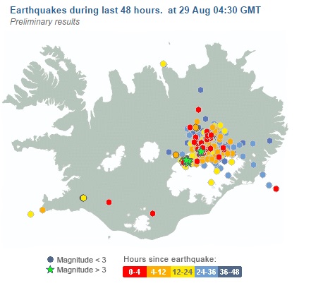
High rains (which happen from time to time) and undredged rivers will inevitably result in escape channels for the water being restricted and increase the possibility of water breaking out of the river channels and finding their own way to the sea. In the UK it seems rainfall levels have been very high this winter – but not as high as in 1929/1930. People are now living in much more vulnerable areas than they did before and the lack of dredging – mainly to protect some form of plant or wildlife – has led to – or at least contributed to – some of the flooding that is currently being experienced. Sections of the Thames have been left undredged to protect molluscs!

Apparently the same form of green idiocy  has also been prevalent in the US. In South Dakota plovers take precedence over humans and in northern California, the Delta Smelt – a small fish – is preventing the release of waters which could alleviate the drought being experienced by many farmers.

Human Lives Being Imperiled to Save the Mollusc and the Plover

It’s time for the American Environmental Protection Agency (EPA) and its British counterpart the Environment Agency (EA) to put humans first on their epic Endangered Species Lists. 

The new mantra of everyday people who make the populations of the U.S. and Britain should be: ‘People First, Rare Molluscs, Plover, & Delta Smelt Last’.

Thousands of people in both nations are being flooded out of house and home and lives are being imperiled because weak western leaders like Barack Obama and David Cameron allow their environment protection agencies to continue to cower to the demands of radical environmentalists.

Out of decency for the devastated, photo ops for Prime Minister David Cameron and politicians visiting Britain’s flooded areas wearing “wellies” (as in Wellington rubber boots) should be curtailed. …… 

It now turns out that in spite of the afflicted region being one of the most ‘undefended flood plains in England’, the Thames was not dredged in case a rare mollusc was disturbed. (Daily Mail, Feb. 13, 2014)

The EA,  of course is claiming that the mussels were not the only reason the Thames was not dredged, even though in a 2010 report, seen by the Mail, they ruled out dredging between Datchet and Staines because the river bed was home to the vulnerable creatures. ….. 

Even with devastation as the result, in South Dakota the waters of the mighty Missouri River are held back each spring to protect the plover, a shore bird that nests along the Missouri. 

“If they let out too much water in the spring, it drowns out their nests and kills the baby birds.  So the corps holds it back to allow the birds to hatch.” (William Kevin Stoos,CFP, June 1, 2011)

“Fast forward to the spring of 2011.  As I watch my friends in Dakota Dunes frantically trying to escape the mighty flood waters released in record amounts by the Corps this week, while their houses are ruined by the Muddy Mo, and my friends, neighbors, and family members work feverishly to protect our own homes and each others’ homes in Wynstone, South Dakota—up river a ways—I thought about the plover. ……

That’s the true tawdry tale of the plovers saved by environmentalists along the Missouri.

Then there’s the never-ending curious story of the Delta Smelt, a tiny fish that is exclusive to the Sacramento-San Joaquin Delta, a once fertile area that serves as a transition for water originating in northern California, ending in water delivery west of the delta for agriculture and south of the Delta for citizens of southern California.

According to Save-the-Fish radical environmentalists, pumping stations used for water delivery were pulverizing the smelt and leading to a dramatic decrease in population and possible extinction.

“The Delta smelt is not edible, does not eliminate pests or have any meaningful commercial value.  Sometimes, despite environmentalist’s protestations to the contrary, certain species reach a natural evolutionary dead end,” wrote William Busse in the Maricopa County Conservative Examiner back in September of 2009.

“However, using the weapon of the Endangered Species Act, environmental groups sued, and on December 14, 2007, Judge Oliver Wanger of the United States District Court for the Eastern district of California, issued an Interim Remedial Order

“The impact on farmers in the area has been devastating with the San Joaquin Valley unemployment rate reaching 14% and leaving thousands of previously productive farming acres scorched and unusable.  In addition, water utilities in southern California have already begun raising rates and creating tiered pricing to address the 85% reduction in imported water.”

To this day California is still under deadly drought—and still diverting water to save the Delta Smelt.

The incredulous headlines today are about a snowstorm in Washington. A snowstorm in winter! Who could possibly have anticipated that?

Environmentalism gives little priority to humans.