Posts Tagged ‘Iceland’

Minnows Iceland make Cristiano Ronaldo a whining, cry-baby

June 15, 2016

I watched parts of the Iceland -Portugal game and was fortunate to be watching when Iceland equalised. I was also watching when Ronaldo missed an open goal and a certain winner just a few minutes from the end.

And the prima donna, that Ronaldo certainly is, started his whining. He accused Iceland of having a “small mentality”. Oh Dear! But their mentality is immense compared to his.

The Guardian:

Iceland have produced another eruption. The smallest country to qualify for the European Championship marked their tournament debut with a result to savouragainst Portugal, although that and their memorable celebrations were not the only tremors felt in Saint-Étienne. Cristiano Ronaldo reacted to a restorative night for the game with all the petulance and pettiness of a spoilt child.

“Iceland didn’t try anything,” whined the Portuguese captain. “They were just defend, defend, defend and playing on the counterattack. It was a lucky night for them. We should have three points but we are OK. I thought they’d won the Euros the way they celebrated at the end. It was unbelievable. When they don’t try to play and just defend, defend, defend, this in my opinion shows a small mentality and they are not going to do anything in the competition.” They have already accomplished more than expected and were at one with their fans after the final whistle while Ronaldo raged at the referee.

Even in a tiny nation’s finest hour in football, Ronaldo demands the limelight and so it is gratifying the prima donna was partly responsible for Iceland producing a performance to remember. His glaring miss five minutes from time, heading Nani’s cross straight at goalkeeper Hannes Halldorsson, not only prevented the Real Madrid man making history as the first player to score in four consecutive Euros but marked the moment the party started for Iceland. The roar that emanated from those in blue behind Halldorsson’s goal said it all. They knew. Iceland had arrived in style.


Light blogging

September 17, 2014

On a trip to Iceland for a few days and blogging will be light.

The Blue Lagoon today.

Iceland warns of potential eruption of Bárðarbunga volcano

August 19, 2014

We are due to visit Iceland next month but that may now depend on how this develops.

The Iceland Met Office has upgraded its warning about a potential eruption of Bárðarbunga volcano and said  there were “strong indications of ongoing magma movement”.

The intense seismic activity that started on 16 of August at Bárðarbunga persists. Very strong indications of ongoing magma movement, in connection with dyke intrusion, is corroborated by GPS measurements. There are currently two swarms: one to the E of Bárðarbunga caldera and one at the edge of Dyngjujökull just E of Kistufell. At 2.37 am on the 18th a strong earthquake (M4) was located in the Kistufell swarm.

This is the strongest earthquake measured in the region since 1996. As evidence of magma movement shallower than 10 km implies increased potential of a volcanic eruption, the Bárðarbunga aviation color code has been changed to orange. Presently there are no signs of eruption, but it cannot be excluded that the current activity will result in an explosive subglacial eruption, leading to an outburst flood (jökulhlaup) and ash emission. 

From Volcano Discovery:

The volcano is hidden beneath the northwestern part of the Vatnajökull glacier, and contains a 700-m-deep caldera that is hidden beneath ice and has extensive flank fissures, from where eruptions have taken place: the Veidivötn fissure extends for over 100 km to the SW, almost reaching Torfajökull volcano, while the Trollagigar fissure extends 50 km to the NE touching Askja volcano.


vatnajokull glacier and its volcanoes image wired.com

vatnajokull glacier and its volcanos image wired.com

The summary issued on Monday says that though intense earthquake swarm continues at Barðarbunga further movement of magma towards the surface has not been detected.

Summary written 18th August at 20:45

Since the onset of the earthquake swarm at Bárðarbunga on Saturday morning 16th August 03:00am, around 2.600 earthquakes have been detected with the earthquake monitoring network of the Icelandic Meteorological Office (IMO), of these around 950 since midnight (17/18th August). Several of these events were larger than magnitude 3. The swarm initially started in the Bárðarbunga caldera and has been migrating in two clusters towards the north and the east of the volcano.

On Sunday 17th of August, these two clusters were active east and north of Bárðarbunga. The activity in both clusters was migrating northeastwards. While the strongest events were located in the northern cluster, the highest number of events was detected in the eastern cluster. The strongest event since the onset of the swarm was detected on Monday morning 02:37 in the northern cluster. Detailed analysis revealed that its magnitude was 4.5 and it was felt in Akureyri and Lón. By Monday evening, activity has significantly decreased in the northern cluster.

The eastern cluster remains active. Two stronger pulses of activity have occurred between 10:45 and 12:00 as well as 16:50 and 17:30 this morning. Within the first pulse around noon, the cluster was again migrating northeastwards, most events are now located between Bárðarbunga and Kverkfjöll. As reported earlier, GPS ground deformation data has evidenced that the earthquake swarm is caused by magma intrusion.

Throughout the whole sequence until now (18th August at 20:45) the majority of events has been at 5-10km depth. No signs of migration towards the surface or any other signs of imminent or ongoing volcanic activity have been detected so far. IMO is monitoring the area around the clock very closely and will update in case of any changes.


Faroe Islands were colonised 300-500 years before the Vikings

August 20, 2013

Somebody got there before the Vikings did – some 300 and 500 years earlier. Norse settlers reached Iceland in the 9th century and probably reached Greenland around the 11th century. But the archaeological evidence is that some unknown colonists had already reached the Faroes in the 4th- 6th century and again between the 6th -8th centuries. There is a theory that they could have been monks from Ireland (St. Brendan?) but I think it is still highly likely that these early explorers/colonists were sea-faring peoples out of Scandinavia.

Mike J. Church, Símun V. Arge, Kevin J. Edwards, Philippa L. AscoughJulie M. Bond, Gordon T. Cook, Steve J. Dockrill, Andrew J. DugmoreThomas H. McGovernClaire Nesbitt and Ian A. Simpson, The Vikings were not the first colonizers of the Faroe Islands, Quaternary Science Reviews (2013)

dx.doi.org/10.1016/j.quascirev.2013.06.011

Faroe Islands -Google Earth

Faroe Islands -Google Earth

Abstract

We report on the earliest archaeological evidence from the Faroe Islands, placing human colonization in the 4th–6th centuries AD, at least 300–500 years earlier than previously demonstrated archaeologically. The evidence consists of an extensive wind-blown sand deposit containing patches of burnt peat ash of anthropogenic origin. Samples of carbonised barley grains from two of these ash patches produced 14C dates of two pre-Viking phases within the 4th–6th and late 6th–8th centuries AD. A re-evaluation is required of the nature, scale and timing of the human colonization of the Faroes and the wider North Atlantic region.

Durham University Press Release:

The Faroe Islands were colonised much earlier than previously believed, and it wasn’t by the Vikings, according to new research.

New archaeological evidence places human colonisation in the 4th to 6th centuries AD, at least 300-500 years earlier than previously demonstrated. 

The research, directed by Dr Mike J Church from Durham University and Símun V Arge from the National Museum of the Faroe Islands as part of the multidisciplinary project “Heart of the Atlantic”, is published in the Quaternary Science Reviews.

The research challenges the nature, scale and timing of human settlement of the wider North Atlantic region and has implications for the colonisation of similar island groups across the world.

Sandoy, Faroes - Google Maps

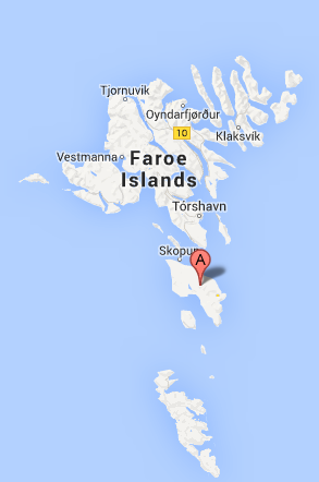
Sandoy, Faroes – Google Maps

The Faroes were the first stepping stone beyond Shetland for the dispersal of European people across the North Atlantic that culminated on the shores of continental North America in the 11th century AD, about 500 years before Columbus made his famous voyage.

The research was carried out on an archaeological site at Á Sondum on the island of Sandoy. 

Analysis showed an extensive windblown sand deposit containing patches of burnt peat ash from human activity, dating human settlement to pre-Viking phases. These ash spreads contained barley grains which were accidentally burnt in domestic hearths and were then spread by humans onto the windblown sand surface during the 4th-6thcenturies and 6th-8th centuries, a common practice identified in the North Atlantic during this period to control wind erosion.

Lead author Dr Mike Church, from Durham University’s Department of Archaeology, said: “There is now firm archaeological evidence for the human colonisation of the Faroes by people some 300-500 years before the large scale Viking colonisation of the 9th century AD, although we don’t yet know who these people were or where they came from.

“The majority of archaeological evidence for this early colonisation is likely to have been destroyed by the major Viking invasion, explaining the lack of proof found in the Faroes for the earlier settlement. This also raises questions about the timing of human activity on other islands systems where similarly evidence may have been destroyed.”

Co-author, Símun V Arge from the National Museum of the Faroe Islands, said: “Although we don’t know who the people were that settled here and where they came from, it is clear that they did prepare peat for use, by cutting, drying and burning it which indicates they must have stayed here for some time.

Swarm of 482 earthquakes (so far) in Iceland

April 2, 2013

Something to watch closely over the next few days. Could a new island be forming?

UPDATE2: 04 Apr 18:57 GMT

The aviation colour code for Hekla volcano has been changed from yellow to green as no further signs of unrest have been detected since it was changed to yellow. The activity in North Iceland has been decreasing today. The activity could still continue for a some time with intense activity in between.

UPDATE: A M5.5 earthquake occurred at 00:59 on 2nd April 2013 about 15 km east of Grímsey island offshore North Iceland. The earthquake was felt at Grímsey, Húsavík, Raufarhöfn, Mývatnssveit, Akureyri and Sauðarkrókur. Several hundruds aftershocks have been detected following the mainshock. The source region is located on a fault system that reaching from Öxarfjörður to the north of Grímsey, the so called Grímsey lineament. Another M4.7 earthquake followed this morning at 08:56 and was located about 7.5km northwest of the night’s main event.

Earthquake sequences are common in this area. It is impossible to predict the further development of the seismic activity and how it might influence faults in its vicinity. Further large events can not be excluded.

==========================================

The Iceland earthquake swarm has now reached a count of 482 according to the Icelandic Met Office.

  • Magnitude less than 1 in all:  39
  • Magnitude 1 to 2 in all:  173
  • Magnitude 2 to 3 in all:  232
  • Magnitude more than 3 in all:  38
  • Total: 482 (upto 712 on 3rd April)
Earthquakes during last 48 hours.  at 04 Apr 19:50 GMT

Earthquakes during last 48 hours. at 04 Apr 19:50 GMT

From Earthquake Report:

Update 10:49 UTC : We have added a Google Earth screenshot to the image series. This Google earth image shows very clearly the many volcanic bubbles at the ocean floor, a result of the separating diverging plates. The 2 tectonic plates are pullling away from each other  (left plate to the West, right plate to the East. This kind of phenomenon is also occurring in the Oceans all over the world. New life (in other words new magma) is added this way to the tectonic plates. The plates are melting away again below ie. the deep trenches of the Pacific Ocean.

Update 10:12 UTC : The Icelandic seismological Bureau wrote : At 00:59 an earthquake about 5.5 occurred, 15 km east of Grímsey. the earthquake was felt in substantial part of central north Iceland. Following the this event at 1:13 another earthquake 4,3 was observed 16 km east of Grímsey and at 08:55 an earthquake 4,7 at same location. Substantial aftershock activity has been observed and still continues. More activity can be expected.

This earthquake is part of a strong swarm at a well know location in the Ocean. The location of the swarm is a relatively shallow ridge area (the zigzagging ridge creates the transform-like earthquakes) . A ridge is a location where 2 tectonic plates are pulling away from each other. Fresh magma will have an easier job to reach the seabed and hot volcanic vents are often found on these locations. A new island in such an area is almost a certainty in the geological future. A pity that there are no permanent ROV’s in this location, we might see some submarine fireworks!
At the time of writing this article, we have counted 314 earthquakes in less than 48 hours!

Screen Shot 2013-04-02 at 12.48.02

Swarm area on Google Earth

Of Mice and Vikings

March 24, 2012

A recent paper from a multinational team of researchers from the UK, USA, Iceland, Denmark and Sweden describes studies of mytochondrial DNA (mtDNA)  in mice to track ancient Viking movements.  The mice genetics confirm the movements of the Vikings some 1000 years ago to Britain and Greenland and Iceland. They do not however provide any confirmation of the fleeting Viking presence in Newfoundland.

Viking movements: map from bbc.co.uk

“Modern house mouse populations were sampled across Iceland (9 localities), at Narsaq in Greenland (near the Viking Age ‘Eastern Settlement’) and in the north-west of Newfoundland (near the Norwegian Viking archaeological site at L’Anse aux Meadows, 4 localities).  Ancient DNA was obtained from archaeological house mouse bones. In Greenland, these were from the Norwegian Viking ‘Eastern Settlement’ (3 individuals) and ‘Western Settlement’ (2 individuals), dating from between 1015– 1165 AD. In Iceland, these were from four archaeological sites in the north of Iceland, three of which date to the 10th C (1 individual per site) and one of which dates to the Medieval period or later (1477–1717 AD; 2 individuals”.

E P Jones, K Skirnisson, T H McGovern, M TP Gilbert, E Willerslev, J B Searle. Fellow travellers: a concordance of colonization patterns between mice and men in the North Atlantic regionBMC Evolutionary Biology, 2012; 12 (1): 35 DOI: 10.1186/1471-2148-12-35

(more…)

Discovery of Icelandic ocean current unsettles “settled” climate theories

August 23, 2011

So much for settled science.

A new paper overturns previous thinking that the East Greenland Current was the main source of the Atlantic Meridional Overturning Circulation (AMOC). The newly discovered North Icelandic Jet (NIJ) is now thought to dominate the return of dense water south through gaps in the Greenland-Scotland Ridge to keep the “great ocean conveyor belt” moving.

Kjetil Våge, Robert S. Pickart, Michael A. Spall, Héðinn Valdimarsson, Steingrímur Jónsson, Daniel J. Torres, Svein Østerhus & Tor Eldevik. Significant role of the North Icelandic Jet in the formation of Denmark Strait overflow waterNature Geoscience, 21 August 2011 DOI:10.1038/ngeo1234

graphic by Reuters

 Science Daily reports:

ScienceDaily (Aug. 21, 2011) — An international team of researchers, including physical oceanographers from the Woods Hole Oceanographic Institution (WHOI), has confirmed the presence of a deep-reaching ocean circulation system off Iceland that could significantly influence the ocean’s response to climate change in previously unforeseen ways. 

The current, called the North Icelandic Jet (NIJ), contributes to a key component of the Atlantic Meridional Overturning Circulation (AMOC), also known as the “great ocean conveyor belt,” which is critically important for regulating Earth’s climate. As part of the planet’s reciprocal relationship between ocean circulation and climate, this conveyor belt transports warm surface water to high latitudes where the water warms the air, then cools, sinks, and returns towards the equator as a deep flow.

Crucial to this warm-to-cold oceanographic choreography is the Denmark Strait Overflow Water (DSOW), the largest of the deep, overflow plumes that feed the lower limb of the conveyor belt and return the dense water south through gaps in the Greenland-Scotland Ridge.

For years it has been thought that the primary source of the Denmark Overflow is a current adjacent to Greenland known as the East Greenland Current. However, this view was recently called into question by two oceanographers from Iceland who discovered a deep current flowing southward along the continental slope of Iceland. They named the current the North Icelandic Jet and hypothesized that it formed a significant part of the overflow water.

Now, in a paper published in the Aug. 21 online issue of the journal Nature Geoscience, the team of researchers — including the two Icelanders who discovered it — has confirmed that the Icelandic Jet is not only a major contributor to the DSOW but “is the primary source of the densest overflow water.” ……..

Iceland volcano watch stands down

November 6, 2010

Jökulhlaup from Grímsvötn subsides

The earlier concern about meltwater flooding from the Grimsvotn glacial lake in Iceland which could have signalled that the volcano underneath was about to erupt has subsided.

Bridge over Gígjukvísl

Figure 1. The jökulhlaup from Grímsvötn: image vedur.is

The jökulhlaup (glacial outburst flood) from Grímsvötn that began near the end of October is now coming to an end. The flood reached a maximum level shortly after noon on November 3, and scientists from IMO visited the site on that day to study the effects of the flood on the region adjacent to the ice margin. Two IMO technicians have performed regular discharge measurements on the bridge over the river Gígjukvísl throughout this week (Figure 1) and the results from their measurements are shown in Figure 2.

Figure 2. Discharge (m3/s) measurements at Gígjukvísl bridge: From the curve the total amount of floodwater is estimated 0.45 km3

The discharge curve is typical for jökulhlaups from Grímsvötn that do not result from volcanic activity: Over the course of several days, the amount of water flowing through an ice tunnel at the glacier bed steadily increases. Loss of frictional heat from the floodwater causes melting of the tunnel walls, thereby increasing the flow capacity of the tunnel.

In past centuries, most jökulhlaups from Grímsvötn have entered the course of the river Skeiðará. This time, however, floodwater that emerged from beneath the eastern part of the glacier went westwards along the glacier margin and then entered the river Gígjukvísl. Skeiðará has deposited very large amounts of sediment on the eastern part of Skeiðarársandur plains over the centuries, increasing the elevation of the sandur area there relative to the central part. In addition, the glacier has carved a trench during times of advance. Thus, it was clear that retreat of the glacier over the past 15 years would sooner or later lead to a drastic shift in the direction of meltwater flow from this part of the glacier. In the summer of 2009, this shift occurred and water has ceased to enter the course of Skeiðará.


Iceland on watch for new volcano eruption

November 1, 2010

Reuters:

Meltwater is flooding from the Grimsvotn glacial lake in Iceland and could signal the volcano underneath is about to erupt, a spokeswoman at the Icelandic Civil Protection Department told Reuters on Monday.

Water now pouring from Iceland’s biggest glacier, Vatnajokull, which sits on top of a number of volcanic hotspots, could be a sign of fresh geological activity, Civil Protection Department spokeswoman Gudrun Johannesdottir told Reuters.

In April, clouds of ash from an eruption under the Eyjafjallajokull glacier grounded flights across Europe for a week, causing billions of dollars in losses for airlines and other industries. Eyjafjallajokull is about 100 km southeast of Vatnajokull.

“We have to check if there will be an eruption,” Johannesdottir said. “Sometimes it initiates an eruption when a glacial outburst flood starts, but not every the time. So we are monitoring the situation closely.”

The latest eruption at Grimsvotn, in 2004, caused short-term disruptions to airline traffic into Iceland.


Smoke from a subglacial volcanic eruption rises above the Vatnajökull ice cap (file photo by Oddur Sigurdsson)


Human pylons across Iceland

September 1, 2010

Human Engineering !

From The Beautiful Brain

“Like the statues of Easter Island, it is envisioned that these one hundred and fifty foot tall, modern caryatids will take on a quiet authority, belonging to their landscape yet serving the people, silently transporting electricity across all terrain, day and night, sunshine or snow.”

From http://www.wired.co.uk/news/archive/2010-08/16/human-pylons

An architecture and design firm called Choi+Shine has submitted a design for the Icelandic High-Voltage Electrical Pylon International Design Competitionwhich proposes giant human-shaped pylons carrying electricity cables across the country’s landscape.

The enormous figures would only require slight alterations to existing pylon designs, says the firm, which was awarded an honourable mention for its design by the competition’s judging board. It also won an award from the Boston Society of Architects Unbuilt Architecture competition.

http://cdni.wired.co.uk/674×281/o_r/pylons.png

Human pylons carry electricity across Iceland

http://img.wired.co.uk.s3.amazonaws.com/659×425/o_r/pylons2.png

Pylons

http://www.choishine.com/port_projects/landsnet/landsnet.html

Despite the large number of possible forms, each pylon-figure is made from the same major assembled parts (torso, fore arm, upper leg, hand etc.) and uses a library of pre-assembled joints between these parts to create the pylon-figures’ appearance. This design allows for many variations in form and height while the pylon-figures’ cost is kept low through identical production, simple assembly and construction.


%d bloggers like this: